I think I went there in May 2012, after visiting nearby Gogubeli Pass..........these are cut and pasted words from that report (the middle paragraph is of relevance to your question)...........
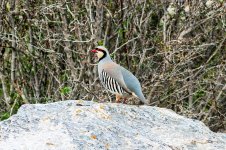
"Off the D350 I turned left for SEKI as signposted (by a beautiful old stone river bridge) - the long approach road to the famous apple sculpture at Seki produced Lesser Grey Shrike, Calandra Lark feeding on a beetle, & the first of many Red-Backed Shrikes. The flooded fields here are worthy of fuller examination. At the sculpture (long 36.801579, long 29.644439) I turned right and after a hundred metres I stopped to watch an insipid, grey-brown warbler than occasionally swung its tail, that I thought could be an Upcher's Warbler (though far more likely Eastern Olly). I am not sure Upcher's occur this far west in Turkey?? The next mile produced superb birding at the famous White-Throated Robin site - 5 such birds being seen (4 males & a female), along with 3 male Black-Headed Buntings, Alpine Swift, several Rock Sparrows and Cretzschmar's Buntings, 2 Ortolan Buntings, & Eastern Orphean Warbler. It was hard to drag myself away. If walking around, just beware of beehives and of antagonising them, though shepherds with goats wandered happily. This White-Throated Robin area runs from the apple sculpture to this reference point (lat 36.792799, long 29.63122). The area inbetween is superb.
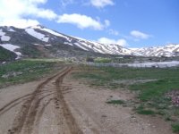
Less than a mile further along the above lane you come to the village of TEMEL. In the tiny square (Lat 36.782961, long 29.620342), where there is a shop and where local men gather during the day to drink coffee around tables, take the unsignposted left turn up the TEMEL PASS, to an used ski-lift point (it was not being used when I was there) 3 miles up the track (Lat 36.738987, long 29.5997). This driveable, stoney road terminates here but you can walk further if so desired. The track from the village initially goes past a small graveyard, turn sharp left immediately before a second graveyard and then it is straight on. The track then goes through arable land, then as it ascends through boulder and scrub filled hillside, and eventually to snowmelt areas with streams. Birding over an hour and a half here was pretty good, with Thrush Nightingale & several Nightingales being heard but not seen. Visual highlights were Masked Shrike, Woodchat Shrike, several Red-Backed Shrikes, Golden Eagle briefly, Kestrel, 2 Eastern Bonelli's Warblers, 4 Ravens, 2 Eastern Black-Eared Wheatears, and near the Ski lift 2 Shorelarks, Water Pipit, 2 Crag Martins, Rock & House Sparrows galore.
Back at the apple sculpture in Seki turn right and weave through the outskirts of the town on the same road following Elmali signs, until you come to the village of Zorlar. ZORLAR was my next port of call to check out, having read reports previously. Keep on the road through Zorlar until you see a track running to the right with red and white railings. I think the co-ordinates are Lat 36.807178, long 29.692014. There is a collapsed roof nearby, see photos at the end. This rough track is driveable quite easily in dry conditions, but it may get heavy under foot as you drive in wet conditions. Initially it does not look particularly promising, running past houses but a Rock Bunting and 2 Redstarts were still seen here. Soon the track opens into superb agricultural land and grassy plains. Within a mile of the access point I had small flocks of Red-Fronted Serins (at least 40 birds) by the ditches at the side of the track, as well as several Red-Backed Shrikes, Hoopoe, 5 Cretzschmar's Buntings, & Long-legged Buzzard. After a mile the track became muddier and with a raincloud encroaching I chickened out and turned back, but with the RF Serins in the bag I was happy indeed."


")