


For Easy Use
- Blank maps can be found here for editors to create distribution maps. Microsoft Paint is suggested.
- Be sure to:
- ...use the file extension .PNG for saving.
- ...use standard file naming: "Map-SPECIES NAME.png".
- ...crop images to focus on distribution ranges.
- N.B. Exception: areas like island groups which are not readily identified in small scale cartography - e.g. Image:Lesser antilles.png.
- ...surround your final image with a 5-pixel, black border.
- ...cite all maps and texts you consult! (In the main species page).
- ...once the image is loaded, click edit and add the text [[Category:Maps]] so it is categorized with all other species maps.
Formatting
When adding a distribution map, you may notice it could fit in funny with the formatting. Luckily, we have a standardized format for the inclusion of these maps in each species account's "Distribution" section:
{| cellpadding="5"
|-
| rowspan=2 valign="center"|
[[Image:IMAGETITLE.png|???px|left]]
|DISTRIBUTION SECTION TEXT
|-
|<font size=4>Legend</font><br />
'''<font color="#HEXDEC" style="background-color: black">•</font>''' ''S. c. ientificname''; year-round<br />
<font size="1">Maps/Texts consulted<sup>[[#References|1]],[[#References|2]]</sup></font>
|}
We use an invisible table to ensure the page maintains it's structural integrity, without the formatting getting in the way of surfing users.
Image:ImageTitle.png
Image title. Again, ensure that it is a .PNG file - we stick with these higher quality images so any edits made in the future to the image do not further degrade the picture's quality.
???px
This piece of code is only necessary if the image's original file size seems inconsistently large or small. For wide images you will want to limit the width to 300px.
Distribution Section Text
Be sure to verify that the information listed in the "Distribution" section corresponds with your map. Any text currently in the "Distribution" section should be moved into this space within the table (N.B. This should not include subsections, e.g. ====Vagrancy====. These should be placed directly after the table).
S. c. ientificname / year-round
Be specific to subspecies where possible. "year-round"/"breeding"/"wintering"/"migrating" where applicable.
Hexdec
Insert the 6 number/letter hexadecimal code corresponding to the colored ranges on your map. Most image editing programs (including Microsoft Paint) provide RGB codes for colors and you can find its hexadecimal counterpart here: http://www.kenjikojima.com/java/RGBHexConverter2.html
References
Be sure to include all maps and texts you referenced or consult during your map creation. These links jump the user down to the "Reference" section of the page (which you may have to create yourself). References can be enumerated in that section using the "#" as a bullet-point for each source.
Category:Maps
At the end of any bird article to which you add a map, add the text [[Category:Maps]] so it's properly added to the bunch!
Media in category ‘Blank Maps’
The following 17 files are in this category, out of 17 total.
 Africa.png 653 × 621; 34 KB
 Andamans and nicobars2.png 171 × 462; 6 KB
 Asia.png 865 × 577; 51 KB
 Australia.png 2,190 × 1,577; 102 KB
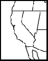 California.png 214 × 274; 4 KB
 Cuba and caymans.png 362 × 159; 5 KB
 Greater antilles.png 638 × 215; 10 KB
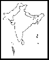 India.png 235 × 287; 7 KB
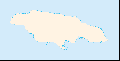 Jamaica.png 673 × 344; 4 KB
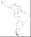 Latin america.png 726 × 876; 43 KB
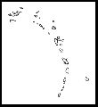 Lesser antilles.png 224 × 245; 4 KB
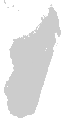 Madagascar.png 1,042 × 2,000; 131 KB
 New Guinea.png 1,068 × 837; 112 KB
 North america.png 681 × 611; 50 KB
 South africa.png 310 × 272; 5 KB
 West indies.png 827 × 550; 25 KB
 World.png 726 × 430; 45 KB


